Miyerkules, Hunyo 22, 2016

MARIVELES TARAK RIDGE 3707 feet

TARAK RIDGE

Brgy Alas Asin Mariveles Bataan
May 9 2016


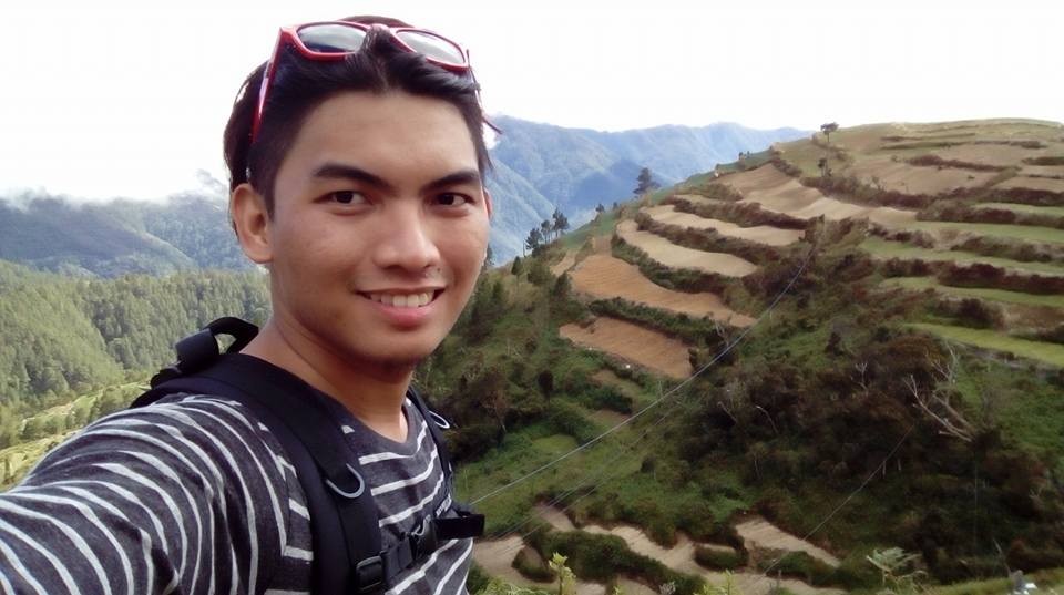
At 3.30 pm after our successful traverse on Mt Arayat exactly a month ago, we were bound again to North West on the beautiful peninsula of Bataan. A well-known place not just for its rich history but for its beautiful mountains of Mt Natib and Mt Mariveles both popular hiking destination for mountaineers and outdoor enthusiasts. This was my 9th official climb and 5th major hike.

It was in the 90’s when AMCI pioneered the first known documented exploration on its summit, now it is well known and famous destination to amateur and professional climbers before Mt Marivles Pantingan’s peak was also discovered by SKY BISCOCHO a pioneer of Philippine mountaineering. Our climb focused on Tarak Ridge.

Joining our team at that time is my friend Jefferson Caparas Barrit and his friend both outdoor enthusiasts, we were total of three. The trail started from Nanay Cording's place to Papapaya River and up to its ridge.  Finally to its summit which has an altitude of 3707 feet. We estimated a 5 hours trek to its ridge which was suppose to be our campsite.The proximity of Tarak Ridge to Mt Mariveles Pantingan Peak is roughly estimated total 12 hours trekking. Furthermore, Pantigan Peak is considered the highest of all peaks in the mariveles mountain range which has an altitude of 4,100 feet.

There is a traverse coming from the other side of Mt Mariveles up to Pantingan Peak down to Bakwat River and up again to the ridge line passing through Elasco Peak downward to the known Tarak Ridge .  Tarak Ridge has  a scale of difficulty of 4 to 9 with a trail class of 1-4.

At 4.00 pm, we were at Nanay Cording's place, the major jump off point of Tarak Ridge. We were 2 hours late on our itinerary, and in a hurry. We planned to camp on Tarak Ridge's campsite by afternoon but we failed to do so because we came late. Its ridge is a 5hours trek from our jump off point. We met fellow hikers resting on the jump off point. They just finished hiking Tarak  a day before we arrived and already on their way back to Manila. After we had our registration on Nanay Cording's  Log book, we commenced our trek on our first Goal Papaya River, we were the last team.


The first part of the trail segment was a typical forest scenery, totally dry because of the effects of El Nino and also because it was summer. I saw large trunks of tree fallen which was cut in half due to strong typhoons that struck the peninsula. Some of those were blocking  parts of the trail.  We had to crawl under or climb over so we could pass through. After 10 minutes, we took our early dinner before continuing our journey.


We arrived on the first view deck by 5PM after 15mins after we had our early dinner.  From the view deck, I could almost see Corregidor Island from a far  and the view of Ridge to the north as we rest for for a bit. We took pictures on our way as we ascend steeper. The soil was golden brown similar to clay but i enjoyed walking through it, because it was much better than a muddy trail. Also,  I had to endure the dusty paved trail while carrying my 25kg back pack. 


 From my left, I saw Rattan, Mahogany and Kamagong and from my right I saw the Ridge.   After 10mins of walking, we entered the forest trail passing through some high grass bushes  which were five feet in tall.  The sun was on the other side of Ridge, so the trail will become unnoticeable.  We geared up our headlights 25min earlier while we were resting on the first view deck. At around 6.00 pm, we  pass the rock formation which has vandalism markings on its side.  It was already dark at  6.15 pm due to tall centenarian trees covering the path. I heard the sound of indigenous birds chirping and chirping around us.


At 6.30 pm,  it was totally dark.  We switched our lights on.  My head light attached to my backpack and LED light from my buddy, Jeff,  lightened our way.   The trail was continuously flat and some of the segment had big rocks blocking it so we need to get around it before we could pass through. We were walking 3hours  from our jump off point. There were hikers ahead of us but we did not exactly know where they were physically at that time, plus with no guide and only a GPS, we just trusted the trail. Since it was our first time hiking Tarak we were not  familiar with its terrain.  I refer from the blog sites I read once.  There were mountaineers went missing in Tarak for 4days because of wrong turns, I was thrilled! (I really like adventures and wilderness.) After 30mins of walking, we saw lights coming from a distance, I heard stream of flowing water, an indicator that we were close to Papaya River.


At 7.10 p.m. we were approaching the lights we saw, I heard voices of people having fun, I saw campfire and I also heard music playing from the radio. We had to cross the river when we arrive in Papaya, which was the camping site, we had to tiptoe on the rocks so we could cross. The water was running smoothly and was also very clear!  Some mountaineers welcomed us and ask if we would joined them.   My group eventually agreed to camp with them because it was already 7.15pm, and because according to our new friends it would took us around 1 to 2 hours of assault in the 2nd part of the trail which is the steepest part of Tarak and also because our team was already starving. Although I was initially motivated to continue, my buddies were hesistant to continue so we agreed to assault the Ridge the following morning.  We set our tent and prepared for our dinner.


We finished pitching our tent at 7:45 p.m..  We prepared for dinner, we got our water source from Papaya River which we used for cooking.  The river was so clean and cool. I set a campfire to dry my shoes because it was soaked wet earlier when we were crossing the river. It was 8.30pm when we finished our dinner and by 9pm LIGHTS OUT!


The next day at 4.45am my alarm woke me up, it was cool, quiet peaceful morning. I began meditating for 15mins on top of a rock before my hiking buddies came out. We started to prepare for our early morning assault and planned to have breakfast on the summit. We just drink our morning coffee, after we pitched our tents. We refilled our water source on Papapaya River and by 5.30 a.m., we were back on the track.

The second part of the trail segment was the steepest part of the trail we have encountered so far. Papaya River lies beneath the heart of the Ridge and is also located on the lowest part.  I have concluded that to ascend from Papaya to the Ridge is considered the most challenging part of the trail considering the time required to reach the ridge is actually just one and half hour.


We started stretching at 5:15 a.m. before commencing our assault.   We crossed the same Papaya river again and continued our trail going to the right.  The trail features  a well establish stair steps made of rock segments.  We met fellow hikers assaulting the second part and was also on their way to the Ridge, yet, we push through until we arrived at the Giant Balete tree.  It was 6.30 am.


I met a professional mountaineer who was also an ultra-marathon trail runner and we had short talk.  He was busy guiding a group of newbies.  It was his ninth time assaulting the Ridge. From traverse to exploration climbs, he had done major hikes ranging from the hardest climbs of Mt G2 in Sibuyan Island and Mt Halcon in Baco Mindoro.  Two of the hardest climbs in Philippine Mountaineering and both 9/9 in difficulty and was dubbed by GIDEON LASCO two of the KNIFE EDGE trilogy. He was set to summit PUNCAK JAYA (carztenz pyramid) in Indonesia late part of this year.  Puncakjaya is one of the 7th Summits in the world and the highest mountain in the Pacific Basin with an altitude of 16,027 feet.   I was amazed by his passion.  As an amateur climber, it was an overwhelming feeling to meet people whom I have similar passion in life especially on the outdoors.


By 6.40 am, we continued our assault on the Ridge. This was the time when the trail got steeper. We continued assaulting   for 30 minutes of solid vertical trail, at 80 degrees slopes. I had to use both of my hands and my trekking pole for support.


We arrived on the ridge at 7:10 a.m.,  I was mesmerized by the stunning view of Corregidor Island, the Manila Bay which was behind me and a preview of Tarak Ridge's summit. We met a large group of fellow hikers descending the Ridge.  They have traversed from the other side of Mt Mariveles. We continued to push through passing the Grassland segment which was dry and golden yellow. The wind was strong as I could feel the cool summer breeze right where I was standing. We pass the the campsite area of the Ridge and there were hikers camping the shaded part of ridge while they were busy making breakfast.  We took time capturing beautiful moments.  It was PRICELESS!


7.45 when we resumed assaulting the ridge towards its summit which was about 30mins away.  The 3rd part of the trail was very dry and dusty, I needed to crawl on the  upper part of it. Eventually not taking precautions, I didn't notice the rattan that scratched my left arm, but thankfully I have first aid kit. By 8.30am we left our bags on the view deck right before the summit which was 10 minutes away.


The final segment of the trail was composed of roots, trees and bagging's that served as handles so that we could push ourselves up from the big rocks covering the trail, finally at 8.45am we were on the summit of Tarak. The half part of it was covered by trees and rocks. We continued walking until we saw the wonderful 270 degree view of Mariveles City, West Philippine Sea and Mt Mariveles. The sun was shinning on the great Sunday morning.


I thanked GOD for the wonderful view, all our efforts paid off after 6 hours of trekking. We rest on the summit for 30 minutes while taking pictures until we met fellow hikers enjoying the majestic view. There was a higher peak so called "elasco peak" but we were hungry that time that we decided to eat breakfast.


We decided to descend at 10 a.m. after having enough time taking good shots on the summit and its great scenery and topography.   I realized how massive Mt Mariveles was. Up until this date, some parts of it has not yet been discovered.   We just explored the known 20% of the whole mountain range.  Probably there were more beautiful peaks waiting to be discovered and I have high hopes someday I can join an exploration team discovering it. There was known story from its peak. It was Feb 9 1942 during the heat of World War II when a young Sgt Toshida Kurosawa, a Japanese Fighter pilot of a (KI97), fought a dogfight batte between an American P40 warplane, eventually Kurosawa's plane (KI97) crashed close to Tarak's summit killing Sgt Kurosawa.


(photo credit to Kevin R Hamdorf)

It was only in the year 2007 when a team of explorers searching for missing WW2 pilots headed by Col. Ralph Wetterhahn (Ret USAF) and a group of Aetas who served as guide retrieved the remains of the missing aircraft together with a tooth of a human being and was believed to be Sgt Kurosawa's remains. The interesting part was it was just hundreds of feet below the summit. (See above photo)


10.30am we met fellow hikers ascending  their way to the summit while we were descending, I saw mountaineers pitching their tents on the ridge. We reached the 1st view deck by 10.45am it was now already hot. We continued descending until were finally back again on the steepest part of the trail.


We arrived on Papaya River by 12noon, we prepared lunch before going back to jump off point, by now we saw the hidden beauty of Papaya River, its calmness, its crystal clearness, its clean and cool water were freely flowing from my foot. We prepared our lunch and after were finished we jumped into the sacred spring. it was refereshing and cool, a relief from the hot weather. We met foreign hikers and local hikers who were also enjoying this wonderful gift of nature. 
(Note that the water from Papaya River is potable and safe)


We finished by 2.30pm we were together with hikers camping just beside the river as we continued our trek by 3.00pm we finally bid goodbye to this beautful gift of nature, We trekked the whole terrain in just 2hours, an hour earlier yesterday when we're ascending. We met felow hikers on their way to Papaya River, and we reached the first view deck on the first segment by 4,30Pm we rest for a bit and by 


5.00pm were back on Nanay Cordings place. Nanay Cording welcomed us, she is the old lady kown to mountaineers hiking in tarak. She own a litte store besde the jump off point. I was carrying a bag full of trash we collected on Papapaya River when nanay Cording thank me for protecting the mountain. I was relieved and touch by this old Mountain lady as she offered us drinks but we were in a hurry because we have to catch up the last trip going to Manila befor 6PM 

By 5.45pm we were on our way to Manila


Mt Mariveles possess a rich history that has not been known to many, and those who sought to discover it will see its hidden treasures. Its people, history and its kindness will make everyone climb back to Tarak over and over again.


TARAK RIDGE
Mariveles, Bataan
Jump off point: Brgy. Alas-asin, Mariveles
LLA: 14°30.357′N, 120°30′E, 3,310 feet (ridge); 3,707 feet (peak)
Days required / Hours to summit: 2 days, 5-6 hours
Specs: Major climb, Difficulty 4/9, Trail class 3

source pinoymountaineer2016


Sabado, Hunyo 11, 2016

Mt Arayat (Traverse)
April 9 2016

6.00Am we were bound to North Again to summit one of Central Luzon's famous mountains, known for its majestic beauty she is one of the pride of central Luzon, standing at 1026masl (meters above sea level) all is set after 2weeks of planning. Joining us for this hike is my friend John dick tambo, and his team for this first major traverse we organized. we were total of 11


the trail will start at brgy Magalang which was our entry point up to north peak down to ridge line between north to south peak and back again up to south peak facing pampanga river finally down to our exit point which was brgy bano Arayat Pampanga. The entire traverse which was roughly around 11 to 12kms took us 13 hours total trek assault

2.30pm we arrived at our Jump off pt secure our Guide and we prepared for our afternoon assault on North peak, we expected to summit at Northpeak by dawn so we geared up our lights for a long tiring 12km traverse. Guiding us is kuya Larry you can contact him at (0926-67157756)


first part of the trail was flat dusty roads, well established trails and concrete ladder footsteps will be seen leading to steeper trails. The leaves and trees were dry because of the scorching summer heat, our 1st goal was to reach white rocks formation before dawn, we under estimated the mountain that's why we just brought 3 liters of water supply per person, not knowing the length of the trail it was one dry hot summer.


4.00pm we just took a break under a big mango tree, we saw fellow hikers descending from the north peak and on their way to brgy magalang which was our entry point, we continue to move at 4.30pm, until we reached the rocky part on the foot of haring bato at roughly 5.30pm, finally smooth breeze of the wind coming from the forest gave us relief, we took photos of the giant balete tree


the 2nd part was more difficult, after we pass the junction of the rock formations, steeper trails consisting of 75 degrees welcomed us on our way to haring bato, we were motivated because each one of us physically prepared for this major hike which was on a scale of difficulty is 5 out of 9, with a trail class of 1-4.


6.00pm after 3 and half hour of trekking we finally arrived in haring bato area, between the junction of the north peak and rock formations was  astonishing view of Pampanga, i estimated we were roughly 2000ft above sea level. we took pictures in haring bato area. eventually it took us 30mins to enjoy the cold summer breeze of mt arayat. We were mesmerized by the sun set, we took photos of some wonderful rock formations 20 to 30feet in height and around 10meters in diameter. My hiking buddy Gerald Kumapn took a photo of us adjacent to north peak, we can see the ridge line from haring bato area.


6,30pm we were already finish taking pictures on haring bato area and we were bond to assault the final part of the north peak trail, from haring bato to north peak it is estimated an hour or two, we departed at exactly 6.30pm. we geared up and attached our head lights and torch lights

6.35pm we continued assaulting the summit, as we ascend steeper trails and colder breeze welcomed us. roughly around 7pm total darkness engulf us, we can only hear sounds of crickets and silence of the wind, the calmness of the forest gave me peace of mind, an indescribable feeling of inner peace. i also heard indigenous birds chirping around us.


7.25pm  i was already exhasted. after more than 5 hours of nonstop trek, we decided to to take a break, other members of my team were already 5 mins ahead of us they were also resting after an hour of steep assaults. I can already feel the stress on my legs but eventually we pushed through. The summit was just 20 mins away, so we charged the final strength we have,.

7.55pm after 6 hours of solid trekking, exhausted and catching my breath we arrived at North peak which was around 3366ft above sea level, and was nick named (SINUKUAN PEAK) "peak of surrender", i removed my back pack and rest. The north peak has a well establish military detachment we were surprise because of the presence of electricity on its summit. It includes a guard house that has an aircon facility, a tv set and even a refrigerator. It is guarded by one military personnel, at the center of the army detachment there was a tower that seems like a receiving beacon of the army facility. 

8.10pm surprisingly the officer welcomed us, we camped at the southern most part of the north peak there was also a mini cottage facility half of our team was busy pitching the tent the other half was busy cooking for dinner, we were all hungry. some of us wanted to sleep and we were just 40% of our traverse expedition. We took an early dinner and by 9.00P.m lights off we were 3 tents.


 4.45Am my alarm woke me up, my tent buddy Daryl Aquino was also awake that time. it was a cold and peaceful morning, and soon it will be the toughest day on my summer hikes, i opened the tent and i saw the dawn soaring at the sky. that was the most beautiful sunrise i have seen so far this year, i realized that there are things money cannot buy, and to feel so alive is one of the most wonderful feeling, kudos to this photo. 


we took selfie's and pictures on sinukuan peak, until the sun is up and shinning it was

7.00Am and the sun is shinning bright we prepared our heavy breakfast, following our morning assault to south peak which was 2kms away from the north peak passing the White Rocks and almost 3 hours away from north peak so we ate heavy breakfast. Our journey was at 40% completion but eventually our water supply is less than half. my 3 liters yesterday was now reduced by 1 liter. and we were just 40% of the whole traverse

after we patched some things and done with our morning breakfast we pitched our tents down and repack our stuffs we took a groupie shot


8.00AM we started trekking to south peak via ridge line it was 1.5kms of forested knife edge like trail. The wind was cool some kinds of flaura and fauna can be seen, scenic view of pampanga and nueva ecija can also be viewed from some parts of the trail huge bagging and old oak trees were also present..


10.30am when we arrive at white rocks area after up and down trail and a little bit of rock climbing we have completed 60% of the ridgeline we took a break and captured the moment the view from the white rocks was exquisite from my right was the whole parts of dau and san fernando pampanga, i can also view zambales and tarlac, from my left i saw pampanga river again and some parts of nueva ecija.


White Rocks was like haring bato segment the only difference is that white rocks is the final segment of the 2-3class trail, the only way we can continue our trail was to rapel 80degrees from the top of the 20-25foot rock formation. We took time to take some selfies and photos as we could. My hiking buddy Gerald kumpan and John Rey first took the challenge with their back pack and gear they carefully descended and rappelled safely to the other side of the white rocks.


We slowly put our bags down to the other side of the white rocks and one by one my team rappelled down safely  as soon as all of my teammates have successfully descended then comes me as second to the last.


From the white rocks to the south peak was one of the steepest vertical assault we have encountered, astonishing 75 degrees to 80 degrees again challenge us on our way up to south peak. My water source was already half a liter and we were not even in the south peak yet. I started to feel the heat because of the sun it was 11.15am but thankfully there were trees on the trail so the heat we felt didn't bothered us that much.


Me, Gerald and Daryl were last of the group because we stayed much longer on the white rocks segment to take some photos and to assist some of our team members. The punishing assault we took from white rocks to south peak reminded me of Tarak Ridge. The trail was composed of steep dry narrow trail and some roots and baggings were there for support and atlast we finaly made it on top of the south peak and it was 12,00noon.

12.10pm when we arrived at south peak camping grounds my teammates were already there on the open grounds and somehow resting, Catching my breath i also took a break under the old oak tree. after 10min we left our back packs on the camping site of the south peak so that we could proceed to the view deck which was 10mins away from the camping area. 


Our exhaustion and fatigue suddenly disappeared when we finally reached the view deck of the south peak, a beautiful view of Pampanga river. We didn't spend much time on peak 2 because of the summer heat and after 10mins we were back on peak 2 campsite. We rest again and resumed our trek before 12.25pm. My water source was less than half a liter, and from the south peak to the exit point it was 3 hours away with an estimated 4-5kms in distance.

Conserving my strength we push through. saving every drop of water as we could. from the south peak we descended much faster because we felt our water won't last an hour.


The first part of the descend was still well establish forest trail,  the wind was still cool but when we arrived on the next segment of the trail have gotten much steeper descend, my legs were bit exhausted.

1.30pm we were roughly 80% of the trail, my water source was already wiped out, the sun is soaring hot in the sky plus the temperature started to bother us, we were walking roughly 5 and half hours from the north peak. and we still have 2.5km trail left to trek. our guide estimated we are still an hour away we still push through rest, trek, descend, and so on 

2.15pm everybody was exhausted i have no water luckily my friend and hiking buddy John Dick Tambo gave me and my fellow hiking buddy Gerald Kumpan a shot of the scarce water. We were saving every drop and were still thirsty, different thoughts were bothering my mind, the trail descending Mt Arayat was much longer compared to its ascend to the North Peak. A real traverse indeed. John Rey and Jovy together with our guide kuya larry was leading the way, they were 30mins ahead of us.


  It was around 2.20pm when all of our water source was wiped out. but we were still in the trail descending, now we were trekking 6 and half hours, exhausted and now no water, my  leg muscle started to cramp from non stop walking plus my back pack which was roughly 15kg added more suffering, yet still we have high hopes, we motivated each one after 10mins of walking the trail   now started to feel a bit  lighter, our moral boost as we can see we were closely approaching  brgy bano. i estimated we were still 300ft above sea level the trail was dry, the grass was golden brown and dusty, i can see signs of Kaingin on the pave road of the beautiful mountain.


 Now we were running on the trail. for 20 mins nonstop it was hell we were in the open so it was very hot i think it was 38 to 39 degrees Celsius on that hot afternoon after our last final break. we trail run again i cannot feel my legs now it was numb, but we were all motivated after 15mins finaly i can see concrete roads. it was around 100 meters away.

FINALLY! 3.10PM we were on the exit point, I was 8th to the last after Gerald kumpan and before John Dick tambo. I immediately bought my favorite mountain dew and a bottled water in less than 30 seconds i already finished it all but i am still thirsty. 5mins passed it was when Aaron and Emil Ken arrived on the same spot, Ate on the other side offered us free water with a block of ice, we secured our guides fee and the entrance fee which was 20 pesos and at last we finished one of the most difficult climbing experience this 2016 we rest for two hours and freshen up. it took us 13hours total trek conquering Mt Arayat Traverse,

by 5.00pm we were bound to san Sn fernando and by 7pm we were on our way to Manila. 


Truly every mountain has a unique beauty but one must have strength, spirit and will to climb her doorsteps before seeing it. As mountaineers saying " never under estimate the mountains you climb she can be beautiful but she can also be dangerous" we under estimated Mt Arayat but we survived, a mistake that we will never repeat again but we had wonderful experience as young amateur climbers we hope to see her back the soonest!


Arayat and Magalang, Pampanga
Entry point: Brgy. Ayala, Magalang, Pampanga
Exit point: Brgy. Juan Bano, Arayat, Pampanga
LLA: 15.2067N, 120.7441E, 1030 MASL
Days required / Hours to summit: 1-2 days / 5 hours (NP) 8 hours (SP)
Specs: Major climb, Difficulty 5/9, Trail class 1-4 (10-11kms)
Features: Tropical forest, scenic views of Central Luzon


source pinoymountaineer2016


Huwebes, Hunyo 9, 2016

My first hike on Luzon’s highest PEAK


November 31 2015
(kabayan Benguet)


12.30pm Finally After Months of Planning we are all set to summit Luzon’s highest peak together with my hiking buddies, Mark Andrew, Daryl Aquino and 5 of my team whom I have cofounded a mountaineering organization which aims to travel the Philippines with less resources possible by hiking mountains and exploring wonderful beauty of nature, we had plan to hike the highest mountain in the island of Luzon which is 2922masl (meters above sea level) via Ambangeg Trail and is typically the easiest trail for non-mountaineer. I have dreamed of becoming a mountaineer when I was on my teenage years because I was thrilled and excited by the idea of Wilderness furthermore I enjoyed nature typically because i am a Zen student


It was passed 1.30pm when we arrived from our jump off point in kabayan Benguet, we had started trekking past 2.00pm paid for the fee and the guides for our one of a kind adventure this year. We started trekking concrete roads which lead us to narrower trail, my hiking buddies took pictures of scenic view of Rice terraces, they were same replicas from banaue in Ifugao, after 1 hour of walking pave and dusty road, the struggle started on our way before camp 1, punishing assaults welcomed us on our way thinking it was the easiest trail to the summit.

Passed 4.00pm we reached camp 1 a waiting shed like house for campers, mountaineers, a preview of the mossy forest a cold breeze started to give chills on our way when we entered the mossy forest. After 30 minutes of walking we reached the first water source. It is a bamboo like water tube system from the springs quenched our thirst and refilled our body strength, a real MINERAL WATER

5.00am I was already exhausted, we were walking roughly four hours and different species of plants from the mossy forest struck our eyes as we entered deep in the woods, it was wet and muddy trail and the breeze was cold, I felt like I was walking on a different world the temperature started giving us chills ever since we have entered the mossy forest, when I checked my thermo stat it was roughly 10 degrees Celsius, it is scientifically colder than the mountains due to its altitude. We took photos on our way to camp 2 and we reached finally camp 2 at 5.30pm.

Standing at 8000ft, I was exhausted it was my 3rd time hiking a mountain since my major hike on Mt Makiling 6 years ago, scenic view of the summit, wide range of Flora and Fauna and a chilling FOG welcomed us on Camp 2, my thermo stat is at 9 degrees Celsius when we breathe fog normally comes from our nose, the weather is like autumn and we met hikers camping at camp 2. We geared up and put on our 2nd layer of clothing, we set up out tents and camp for the chilling night, it was passed 7pm and darkness soon engulf the sun turning our place to a winter like environment, we prepared dinner and finished at 8pm, my hiking buddy Cedric Francisco was also exhausted and took a nap on our tent.We ate our meal and turn the lights off by 9p.m. I put my 3RD layer of jacket, thermal gloves and 2 socks but that did not prevent the cold from entering our tent. It was passed midnight when I felt sudden drops of water outside our tent, it was raining very cold and freezing temperature after 30minutes of squall suddenly the temperature had dropped and I felt I was sleeping on a freezer.We didn’t have proper equipment’s that time our only protection from the cold and mossy ground was a sleeping bag covered with plastic, the chills didn’t gave me a nice sleep, although I was wearing 3 layered clothing my foot felt the frost so I eventually put it inside my bag just to take a nap, my tent buddy Cedric Francisco also felt the chills because of the altitude and the rain factor it was the longest coldest night of my life, wishing that I would see the sun again..


3AM my phone started to alarm, when I woke up I already felt the chills from my foot, I suddenly opened the tent and the freezing dry air started to enter our tent it was our wake up call. i took my flashlight and again check my thermo stat it was freezing at 2 degrees,. My reading was at 2 degree but I felt much more colder, strong winds had struck our tent I felt the cold personally because of the lack of thermal wear, so I jog and exercise to make my body warms 15 mins have passed when Cedric came out on our tent also Daryl and Drew they were freezing and not moving on their place, 5 minutes have passed Mary Shane my hiking buddy from the other tent woke up, we initiated boiling water for coffee because the wind was dry and very cold. After I had my morning jogging it was a bit cold but it was already tolerable, I drink the hot coffee after that we prepared breakfast for our morning assault on the summit which is an hour away from our camp site. We departed at 4AM we were a bit late that morning, some of the other groups from the other tent departed an hour earlier from us, we are bound to see the majestic view of sea of clouds from the summit of the mountain which was nick named PLAY GROUND OF THE GODS


Total of darkness engulf us we can only see lights from mountaineers adjacent to us assaulting the summit. It was mossy, the trail was wet because of the rain but you can see frost forming from the flora and fauna from the ground. I was wearing 3 layering jacket and burst of wind from my face gave me struggle of breathing it was DRY and COLD air. I am equipped with my head light and torch light encircled to a stick connecting to a power bank. I was leading the way on our way to the top it was passed 5,30am when we finally took the shortcut trail and the punishing 75 degree assault to the summit our guide told us we were 10mins away, I was catching my breath when dawn struck the darkness from the sky. Clearly from my eyesight I was watching one of the most breath taking moments of my life I pushed through sweating from within and extreme cold.


Daryl, Drew, Sally and Shane on the other side have reached the summit and I was 4th to the last before Cedric Cith and Imma. The sun was in the east our view from the summit was to the south, I rest for a while catching my breath took my phone and took a selfie. The summit was a hill top like covered with grass bushes 1foot tall. The center of it there was a signage stating the summit of Mt Pulag,5.45Am the breathtaking sea of clouds has already been seen from our view point, standing at 9958Ft clouds was just on our foot, it was so overwhelming that i was struck for a little bit and mesmerize on the scenic view of central Luzon, from our upper right I can see baguio from our back facing the north I can see the mountains of amuyao and UGO and Ifugao from my left. Totally unreal but it was real. I thank GOD for giving me the sight to see his wonderful creations a truly one remarkable moment.


 7.00Am passed we took photos and selfie from the top. The sun is shining and it was still freezing I already saw the trail we took to the summit it was like 2 kilometers from our viewpoint. We took rest for a while, we start descending by 7.15am and we reached camp 2 by 8.30am, we took photos on our way back to camp2, then we started preparing for early lunch, by 10am we pitch tent and pack our stuff head back to camp 2 again an exhausting 3hours trek to our jump off point Ambangeg ranger station.


 1.30PM we were already back at our jump off point, and by 4.00pm we were already in Baguio City   after a long drive from ambuclao dam which was our side trip.. Truly Mt Pulag was one remarkable adventure on my hiking activity we would like to come back hopefully next year to try the killer trail. AKIKI which is a 3day 17km 15hours assault from the jump off point to the summit, I was astounded by nature that it was so powerful that I learned to respect her and appreciate her majestic beauty.