Sabado, Hulyo 22, 2017


Mt Mariveles 4,100ft (PANTARAK TRAVERSE)


GABON SITIO DUHATAN, BAGAC 
April 17 2017

BALANGA-  3:00 am, As I reminisce the endeavors of the past exactly a year ago, I was nostalgic on my way to Bataan, having the thought of Mt Mariveles lingered my memories on Tarak Ridge a year ago. Prior to that, We've planned to climb Pantarak many times but never materialized. Only on the second week of April after a failed attempt to trek Kibungan Cross country in Benguet, the plan manifested into life after we settled for plan B which was traversing Mt Mariveles via difficult route.
Known to many mountaineers and outdoor enthusiasts as PANTARAK, the abbreviation of Pantingan Peak Traverse to Tarak Ridge.

It's 23 kilometers of arduous trail and multiple peak assaults again tested our adaptability and knowledge on the outdoors. This blog covers our story of climbing multiple peaks in one distinctive mountain.


BACKGROUND

Mt Mariveles was an extinct volcano located in Bataan peninsula, It is composed of rolling hills, steep trails, with thick vegetation, cleanest rivers, and multiple peaks altogether in one Mountain range. Its creator is home to some uncharted jungle terrains that are waiting to be explored. Mt Mariveles has many other peaks alongside with Pantingan peak and Tarak to name a few. Its highest is what they call Bataan Peak (1400m). Thanks to the efforts of early exploration teams led by Sir Sky Biscocho Pantarak trail was established.

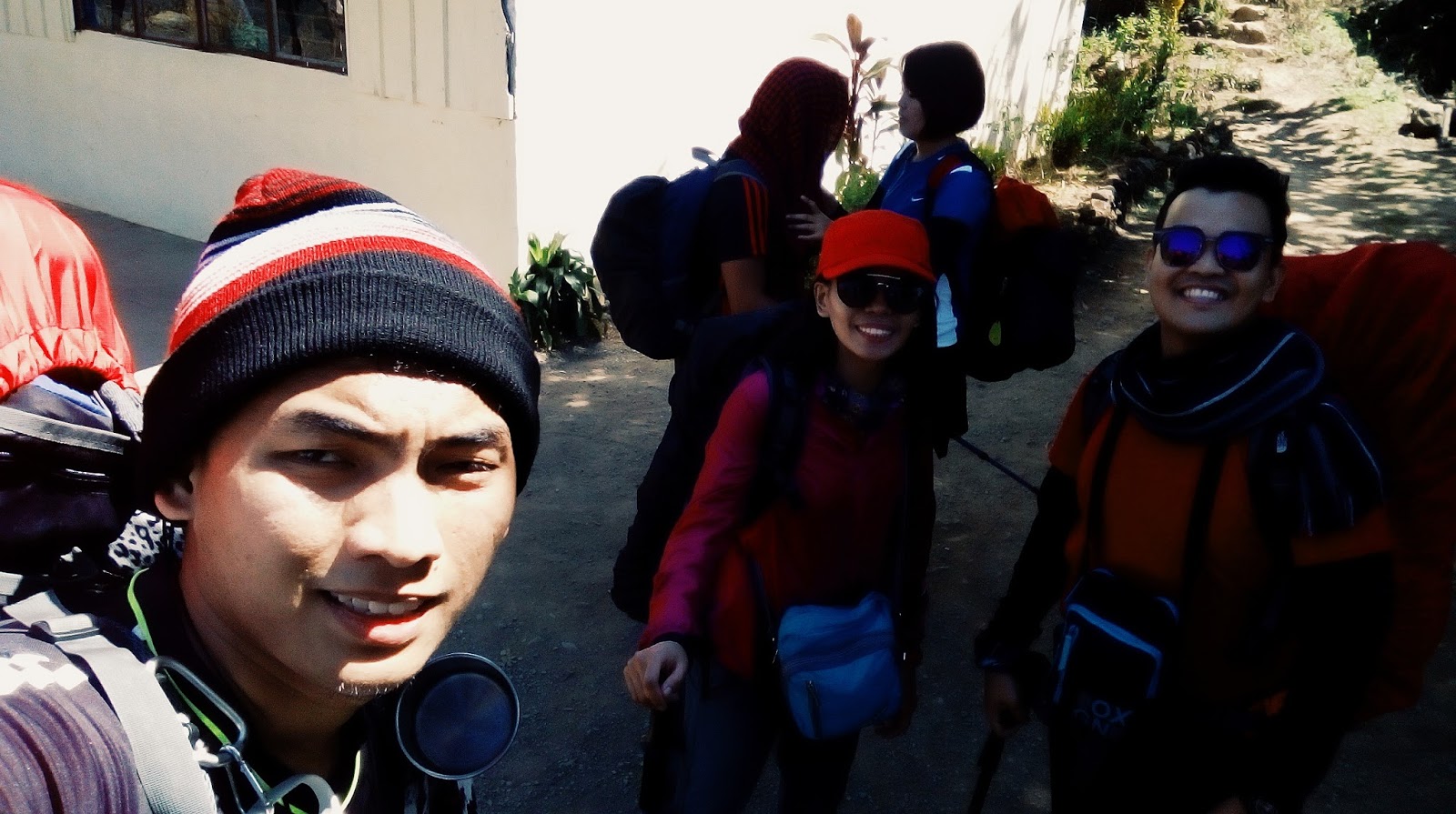
Definitely, not for beginners, the total time completion of the whole traverse took us 32 hours and 18 minutes including camping time. Altogether our team was just composed of the blogger, Jissa, Gerald and my good friend Lemuel.


SITIO GABON TO DANNY'S GATE UP TO PANTINGAN PEAK

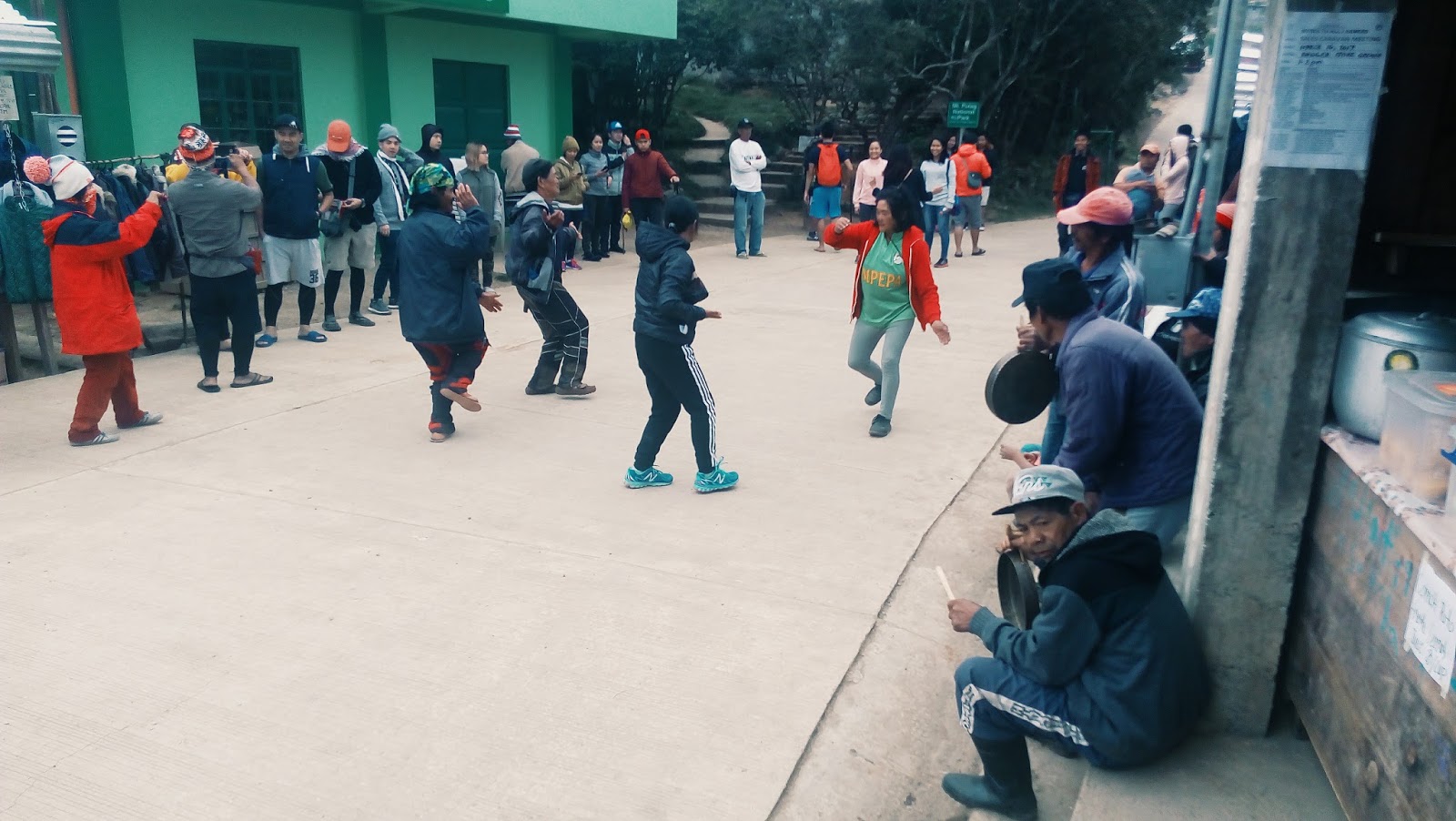
We arrived in Bagac Market at exactly 6:30 am, we bought food supplies that would be needed for the overnight trek and having no courtesy to Mr. Rey or tatay rey made some delays on our itinerary. After reaching the main jump off, we immediately settled our climbing permits to Tatay Rey, one of the most experienced guides in Bagac side.


After settling some undisputed fees plus a short briefing and few sets of stretching we commenced our trek at exactly 9:10 am


River crossing

The first segment was composed of rough roads until reaching the forested part of the trail, from there we crossed 3 rivers and refilled our water bottles until reaching the rolling hills they call Marlboro country, from there a preview of Pantingan summit was more visible.


take 5 moments


A reminisce of Balingkilat

 After passing through the rolling hills the sun vibrantly scattered its luminous light and heat, on our way up to Danny's Gate. It was composed of open trails with tall dry grass that blocked the wind and made us very exhausted and exposed to the radiant heat.


Direct Heat


We cooled down after passing through Danny's gate and prepared our lunch, Little do I know that moment I forgot to bring one of the most important equipment for cooking which was a butane gas!


We immediately decided if we will renounce our trek or persist but to my surprise, we all corresponded to the same thought of recommencing our trek. The good thing was we bought so much trail food as an alternative to the main course.


Nap time waiting for our sweepers

12:30 pm, With renowned vigor, we resumed our trek up to the forested area, until passing through the first steep inclination.


Vibrant colors of nature

It was already passed 3:00 pm we were trekking up to the ridge when we encountered a 2-meter long snake that passed through our path, shocked, we gradually declined our phasing. Our guide Tatay Remy immediately draw his bolo, luckily! the snake moved away from our location and it seems hunting for its prey.


We recommenced our trek after waiting for our sweeper Gerald, from the ridge we've managed to trek for 1 hours without declining our phasing until reaching the final inclined assaults up to Pantingan at 4:25 pm. 


There were good viewpoints that we used to capture some nice shots of the Bataan peninsula and the West Philippine Sea.


West Philippine sea

Exhausted, we summited at around 4:45 pm reaching Pantingan peak after 8 hours from Tatay Reys house, From Pantingan Peak the whole creator of Mt Mariveles can be seen.


Pantingan Peak

We stood still on the pedestal of the mountain range and delightfully enjoyed the marvelous sight that it could offer.


Mt Mariveles Creator

The original Itinerary was to reach Bakwat river before dawn but the plan was renounce due to itinerary delays, thus we decided to e-camp (emergency camp) on the other side of the ridge and trekked for an hour before we could set our tents.


The camping ground can only accommodate 3 tents. We gradually had a difficult time fitting our tents on the limited space it had. 


Darkness engulfed the horizon as nightfall arise, followed by a stiff breeze hence a high wind chill pounded some of the shrubs around our camping site. Good thing we successfully set up our tents at exactly 7:00 pm.

We had some socials time spent but due to the lack of fire, we couldn't boil water and just ate some of our trail food.

Lights out at 8:00 pm!


DAY 2


PANTINGAN PEAK TO BAKWAT RIVER


Good Morning

The next morning we woke up at 5:00 am, we were so exhausted last night we slept for 9 hours, the night was frigid and the morning greeted us with a dewy gloomy weather.

Lemuel

We immediately packed our things, prepared a cold coffee and had a short briefing. Bakwat river is located 500 meters below our camp site so we had break camp at exactly 5:35 am and by 5:40 we resumed our trek.


Slippery descend

The hope of a fine weather was downhearted by the dim sky, we reached the detour to Bataan Peak after 20 minutes, from there we descended 2 hours before we could reach Bakwat river at 7:44 am.


Take 5 

The trail was slippery and needed contortion skills and cautiousness to some extent and the trails were entangled by mossy tree vines.


Bakwat River

Bakwat River was the resting point of Mt Mariveles, only Mountaineers can reach this part because of its entangled and steep down ward trails. Also, there were many reports of missing mountaineers from this area good thing tatay Remy is an expert on this mountain.


After 20 minutes we resumed our trek up to Vinatana peak which was 3 hours away, with full gear back packs we ascend gradually up to some rope segments that we grasped until we could reach the ridge going up to Vintana Peak.


Rope segments

We summited Vintana Peak at 10:45 am and had some few group shots for 5 minutes, shortly after with renowned vigor, we trek up to El Saco peak. 


Vintana Peak

The trail from Vintana to El Saco Peak was the steepest part of the whole Pantarak it needed hand support for grasping large vines before one could gradually ascend up.


Pantingan peak can be seen hiding on top of the clouds

Although it was just more than an hour away from Vintana peak, it pounded our legs hardly that I cannot barely walk later that week. 

It offered also an enticing scenery of the previous peaks we summited.


EL SACO PEAK TO NANAY CORDING


The view Mariveles City

We summited El Saco Peak at 12:06 pm, we had a good 20 minutes spent on the summit after catching our breath from the steep ascends. 


El Saco Peak

From there a very swift one hour descend down to Tarak Peak. It was already passed 1:00 pm when we reached Tarak peak after passing through some entangled obstacles that resembled wild bore trail of Mt Makiling.


We were starving! We haven't eaten rice for the past 28 hours since day 0. The worst thing is our trail foods were already low.


Gerald

We reached Tarak peak at 1:05 pm, The view was very enticing, with an awesome panorama of Corregidor Island and Manila Bay. We just spent some 20minutes of pictures on Tarak Peak and swiftly descended again to the known Tarak Ridge which I climbed a year ago.


Tarak Peak

2:30 pm, when all our trail food was gone, from Tarak to Papaya river we approximated 1-hour trek on fast phase. Hurriedly we trail run down reaching the forested part. While descending It rained heavy leaving the trails filled with mud as thick as 2 inches.


Tarak Ridge

We reached Papaya River at 4:00 pm while the rain drizzled. Starving and shivering we pushed our last energy and resources until reaching Nanay cording's place at 6:40 pm.


Jissa and Gerald reached Nanay Cording's place 30 minutes prior to our arrival so they already prepared our dinner.


6;45 pm, At last! We arrived starving, shivering and exhausted our lingering fatigue was replaced by a nice hot soup and viand alongside with nice warm rice plus a hot coffee that undoubtedly restored our vigor and boosted our morale.


All I can say that time was Rice is life! After 32 hours of trekking without it, It felt like a reward for reaching the finish line. After we had dinner we bid farewell to our guide tatay Remy.


23-kilometers trail

After we freshen up we departed at exactly 8:00 pm via Bus going to Balanga central terminal.  We reached Manila by 12:30 am the next morning


PANTARAK was a test of toughness and endurance, It gave us an essential lesson that every mountain should be treated solemnly regardless of one's readiness. It has a rank difficulty of 8/9 based on other reviews but it was surely a tough adventure for anyone who seeks a real kind of endurance and adventure at the same time.


Entry Point: Sitio Gabon, Brgy. Saysain, Bagac, Bataan
Exit Point: Brgy. Alas-asin, Mariveles, Bataan

Total completion 32 hours 18 minutes for 2D/1N itinerary
Highest peak 1388masl


Biyernes, Hulyo 14, 2017


Mt Pulag (Akiki Amba Traverse) 9,586ft 


BRGY, TUJAKAP, DUACAN BENGUET
March 10 2017


BAGUIO CITY-  5:15 Am, Our eyes were still drowsy, we headed towards the town of Duacan in kabayan Benguet via chartered van from Baguio City after almost 9 hours of land travel from Manila, together with 7 of our teammates we were set to climb Luzon's highest peak the second time via traverse trail of Akiki which was well known to many mountaineers as "the killer trail" due to its gruesome relentless assaults.

The original itinerary was supposed to be a 3 day 2 nights climb for Akiki trail but was shortened to a challenging 2 days 1 night due to our schedule, so the last night on our 3-day itinerary was spent in Baguio City. We finished the whole climb for a total of 29 hours were 18 hours was devoted in trekking.

The first time I climb Pulag was way back in November of  2015 via Ambangeg trail, and the hardship we faced that time was still lingering in my memory. 


BACKGROUND

Mt Pulag is the 3rd highest mountain and probably the coldest place in the Philippines in my opinion, towering at almost 10,000 ft and often called as  "the playground of the Gods". because of its distinctive environment and dramatic scenery. It was also way back 2015 when we experienced below 0-degree Celcius on its campsite. Although, there were reports that Pulag's temperature drops to as low as (-6°C) especially on December to March season. This chilling figure was documented on 2015 when we experienced (-1°C) Celsius on Camp 2 using my portable mercury thermometer. That was the first time I've experienced such freezing temperature in the outdoors, thus I can tell that it is the main element why Pulag is complex and arduous. It's grueling wintry temperature, precipitation, with steep trail plus its enticing scenery will make Pulag amongst your best-loved Philippine mountains. 


the main jump off

AKIKI RANGER STATION 

9:00 am, We arrived in Brgy Doacan, prior to that we had heavy breakfast stop over along our way.  The team was composed of the blogger, Jean, Alex, Thea, Suren, Floro, and Sallie. Although late, we still managed to catch up our itinerary because we've waited for Baguio public market to open, and then bought our supplies in Baguio that will be needed for the 2-day climb. Upon arriving, we've already prepared some requirements needed before climbing Pulag.


team 7


We first registered and settled our climbing permits accompanied by our
 medical certificates to Akiki ranger station. After a short briefing and orientation, we met our guide which also served as a porter to one of my teammates. and around 10:30 am,  we commenced our trek to our first goal, Eddet River.


Scorching Heat

on our way up

Rough roads welcomed us along with the sun's radiant heat 20 minutes after we departed from Akiki Ranger Station.


a good warm up

The scenery was enticing, it was filled with pine trees, a distinctive characteristic of Cordilleran mountain terrain.

11:04 am, we reached the waiting shed area on top of the hill from there we saw a glimpse of the summit that made us delightful and excited as well, the sun's heat was at its finest, as we silently waited for our sweeper,


my bag was 19kg

From the waiting shed, we entered the forested part of the trail it was covered with centenarian pine trees and other low-alpine floras.

We trek one and half hour before we could reach Eddet river.

the trail was well established


We had no other words to say but a perfectly fine day!

Nostalgia


The trail was soothing, it had me reminisce of km 16 of Mt Tapulao.


12:15 pm, We arrived on Eddet River, and prepared for our lunch, cooked some food and had some time to relax a bit. we planned to resume our trek  2:00 pm that afternoon.


EDDET RIVER TO MARLBORO COUNTRY


Eddet River (@1000 meter) altitude was the tipping point of the trail difficulty, from there up to what they call "Marlboro country"  until reaching Pulag saddle camp was filled with steep assaults ranging from 60 degrees to 70-degree angle inclinations.


The famous hanging bridge the start of the assaults

Eddet river separates Doacan from Bababdac and other Barangay's in Kabayan

Marlboro country was named after a cigarette commercial due to their resemblance. Its distinctive features were the highlights of Akiki trail. For mountaineers, Akiki will not be called the killer trail if not for this part of the segment.

2:00 pm, when we resumed our trek after a delightful siesta. After passing through the hanging bridge, the difficulty started to arise.


2:30 pm, We were pounded by steep assaults panting and catching our breath, we gradually ascend from one point to another with 20 minutes interval of rest.


take 5 moments


Bit by bit we successfully adapted to the terrain with sluggish phasing. In the rule of mountaineering especially on high altitude, the slower, the better".


Dry leaves and trees

4:30 pm, We continued to ascend up until reaching the first emergency camp at around 1800m altitude. 


perfect scenery


e-camp

We rest for a good 30 minutes before pushing through. From my perspective, we were not even half of the trail so I prepared for an emergency camp protocol. (e-camp)


5;30 pm The majority of us decided to push a little bit more so that we could camp on higher grounds. Exhausted, we called our sweeper via phone to ask where they were and confirmed their distance 2 hours away from us. Eventually, we all agreed to camp above Marlboro country it was the last E-camp before entering the mossy forest.

It was 2-3hours trek away from our location and roughly 5-7 hours away from saddle camp so we didn't waste time and consumed the last energy on our body.


6:30 pm, we already felt the first chill, the temperature suddenly drop from 20°C to 10°C, the fine soothing weather earlier was replaced by the chilling silence of the forest. We equipped our thermals afterwards.


7:30 pm, It was freezing at 7°C, Finally, upon reaching the campsite we prepared and boiled hot water so that we could have coffee. The E-camp was above 2300m altitude. It had nipa hut that can accommodate 10 persons.


Tired, we camped there and planned to resume our trek at dawn, The night became deeper the frigid wind blew gently. We prepared our dinner chicken stew and after an hour our sweepers Jean and our guide finally arrived.


We ate our dinner and prepared our sleeping pads and thermal wears inside the nipa hut.

Lights out at 9:00 pm.


The night was filled with silence except a chirped from an owl nearby, as the frosty wind from the open window started to cripple our worn out bodies, little by little we felt the frigid air even though we had thermal wears that time. Even three layer of clothing and sleeping bags was not enough because unlike tents, it was an open area.


Day 2

MOSSY FOREST TO SUMMIT


We woke up at 3:00 am the next morning and temperature was low at 4-degree Celsius, I measured using my portable thermometer. That was the second lowest after I measured a -1°C on Pulag's summit in 2015. Even the coldest day in Baguio City at 8-degree was no match for that chilling morning we had.


3:10 pm, Immediately, we heated water for our coffee and had short breakfast, afterward, we packed our stuff and resumed our trek up to saddle camp. We planned to have our breakfast on the summit and started trekking at 3:30 am, by 4:00 am we entered the mossy forest until reaching the last water source. 


Winter layering

As we ascend altitude, the wind blew harder and the temperature started to dip even lower especially when we had to stop for resting. It was already 5:30 am when we reached the grassland area, the temperature this time dipped to as low as 2°C based on my Portable thermometer.


Bit by bit we saw the sun's vibrant dazzling light, as it radiates and gave life to darkness.  It was a very delightful moment, everything was magical!


the gift of sight


Thanks to the Creator.


6:05 am we reached the highest part of the grassland towards Pulag saddle camp which was just 30 minutes away. From that view point whole of Benguet and neighboring provinces of Ifugao and Mountain Province can be seen. 


The sun light illuminated our path as we trek towards saddle camp, we had moments of laughter and photos.


With renowned vigor, we push through up to the summit after reaching Pulag saddle camp at 06:45 am. 


Finally! We reached the summit at exactly 7:15 am, Worn out,  we've still managed to take good photos from the strenuous four hours trek we did. 


the whole of Central Luzon above the clouds

It was my second time summiting Pulag, and  I had a nostalgic feeling of accomplishment, a sense of purpose, humility, and gratefulness within me. Climbing mountains are more than a passion, for me it is sacred and divine. I had moments I thanked the Lord for the gift of life.


360-degree view

We've waited for our sweepers on the summit, they reached the summit at around 8:30 am, an hour after we arrived. We immediately took group photos and cooked breakfast. It was still cold up to the summit and the view was marvelous!


Team Pulag

I asked a mountaineer who camped on Saddle last night, he said it was so cold that night that his tent had frost formation!. We didn't experience camping on saddle because of our itinerary, however, still thankful for surviving Pulag's weather the second time.


I cooked sisig tofu and we had breakfast on the summit at around 9:00 am, the sun was up and shining.


SISIG TOFU ALA MT PULAG!

After that sumptuous breakfast we descended at exactly 10:15 am via Ambangeg Trail the easiest trail to Pulag.


We trekked for an hour before reaching camp 2 of Ambangeg, we had some time spent for hilarious moments that restored our vigor.


 We reached camp 2 at 11:45 am and refilled our water bottles from the nearest source and continued our path through the mossy forest until reaching Camp 1.


We even played jokes while capturing photos on our way down and had some LSS songs played on our phone. That afternoon was filled with bliss.


Camp 1


From camp 1 we managed to trek down for just an hour reaching Ambangeg Ranger Station at exactly 1:40 pm.
Sprint trekking on our way down


2:05 pm, Finally! Our long exhaustion and fatigue ended with a bliss, reaching the end of the path was a very delightful feeling, a sense of accomplishment. 


We even affiliated with Local Tribes of Kankanaey and Igorot on that afternoon while waiting for our service to extract us. They were dancing their traditional Igorot dance.

That afternoon was filled with fun, laughter as we reassess how the whole climbed went through.


Our chartered van extracted us at around 5:30 pm, we reached Baguio at 9:00 pm and checked in to the nearest transient house for our extended Baguio side trip the next morning before going back to Manila.


I can say Pulag has many sides to offer, seeing it for the second time gave me a different perspective on life. Indeed, Beauty can always be appreciated from a different perspective, a true character that makes Pulag distinctive to other mountains.


MT. PULAG (AKIKI TRAIL)
Kabayan, Benguet
Major jump-off: Brgy. Doacan, Kabayan (Akiki)
LLA: 16°34’58″N 120°53’15″E, 2922 MASL
Hours to summit / Days required: 10-11 hours / 2-4 days
Specs: Major Climb, Difficulty 7/9, Trail class 3